
How it works
Coverage
Pricing
Support
Join the waitlist

Most tide charts show a prediction.
TideStrike shows you what's really happening.
TideStrike pulls from multiple reliable sources of environmental data to forecast the water level at your spot, and updates up to eight times a day. Tide, wind, weather, and strike times on one screen. Built for inshore anglers on the Texas coast.
Email address
Join the waitlist
Launching on iOS September 30.
The difference
NOAA gives you one piece of the puzzle.
The standard tide chart is an astronomical prediction. It knows where the moon and sun will be
next Tuesday, and it's very good at that. What it doesn't know is this morning's wind, today's
pressure, or what the water in your bay actually did overnight.

NOAA harmonic prediction

Live observations

CurrentFlow forecast


70%
more accurate than the NOAA harmonic tidal predictions
How we do it
TideStrike pulls from multiple reliable sources of environmental data and re-forecasts the water level at your station up to eight times a day. In a bay three or four feet deep, three tenths of a foot is the difference between writing off the back of a marsh and fishing it.


One screen
Stop checking four apps before you launch.
The tide from one place. Wind from a weather app. Pressure from somewhere else. A fourth tab for the forecast, and none of them agree with each other or line up on the same timeline.
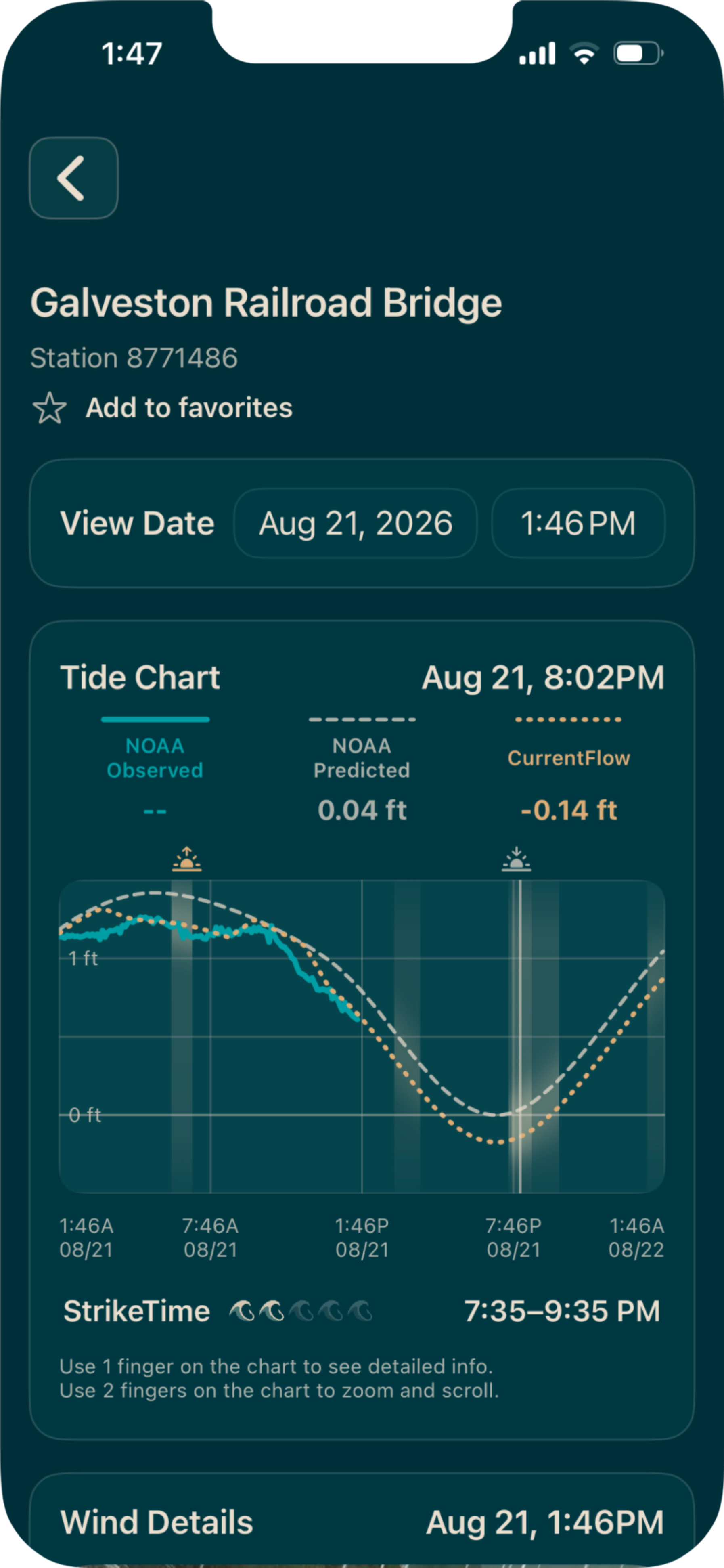
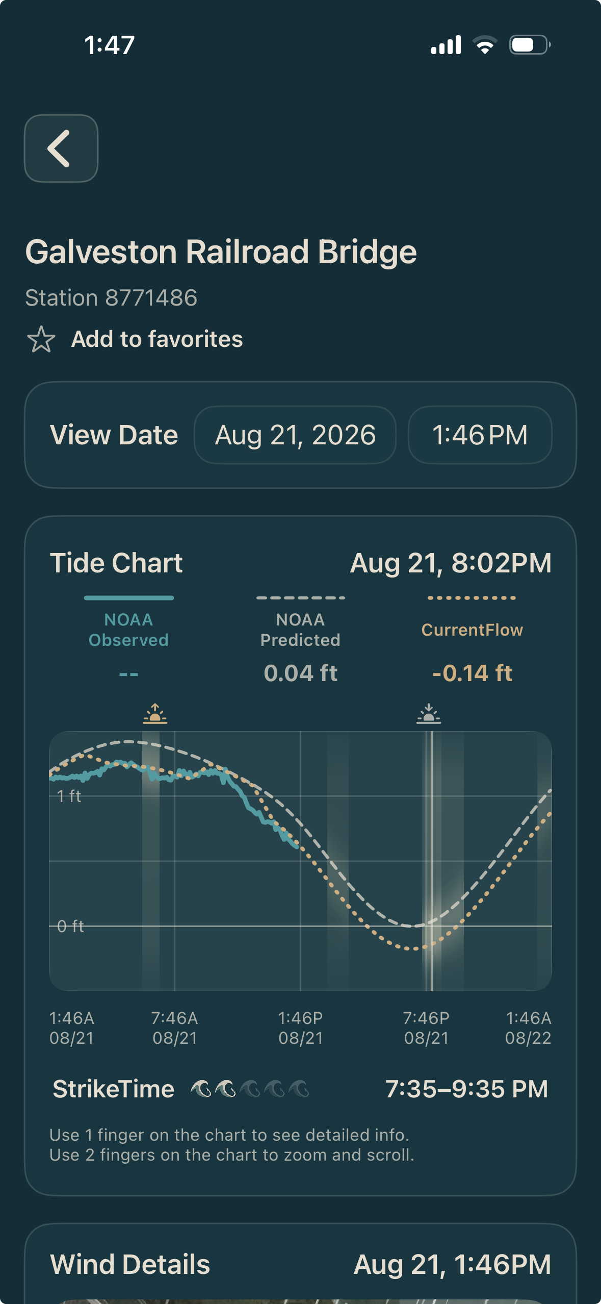
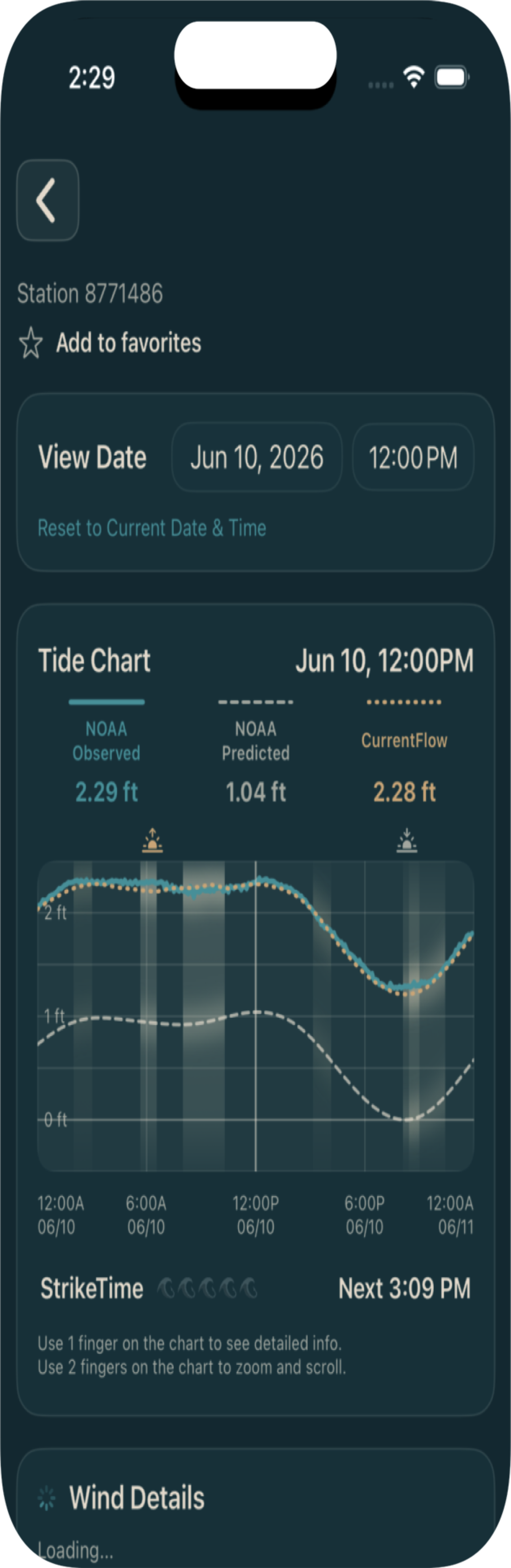
TideStrike puts tide, water level, wind, weather, and strike times on one screen, scrubable by hour, with your spots saved. Open it, tap twice, and the whole day is in front of you.
What you get

CurrentFlow
The adjusted forecast,
refreshed up to eight
times a day.

Tide chart
Prediction, live observations, and
forecast on one
scrubable timeline.

Strike times
Major and minor bite
windows rated under the chart.

Wind
Direction and speed
visualized across the
day.

Weather
Air temp, rain, pressure,
observations and
forecast.

Custom stations
Set a reference station
and an offset for a back
lake that doesn't have
one.

Fishing journal
Log a catch with a photo and it pulls the tide and weather from that moment.

Your spots stay yours
Nothing you save or log
is shared, published, or
visible to another user.
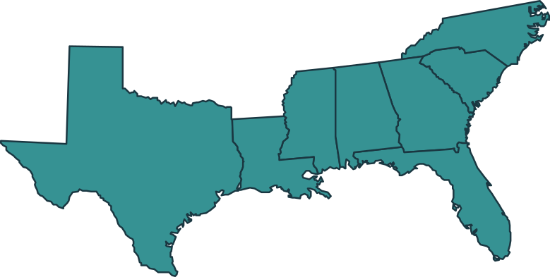
Coverage
Built for our home waters.Working across the Gulf and South Atlantic.
Tide, water level, and weather work anywhere NOAA has a station — which is most of the U.S. coast.
CurrentFlow goes deeper. At launch it covers the Texas coast, the Gulf, and the southern Atlantic — Texas, Louisiana, Mississippi, Alabama, Florida, Georgia, and South Carolina.
Inside the app, every station card tells you whether CurrentFlow is available there. No guessing, and no finding out after you've paid.

What users are saying

"Finally, an app that gives me ALL of the info I need and want before hitting the water! Getting accurate information I can count on is essential for putting customers on fish and the TideStrike app does just that."
Capt. Chris Colin
Location

“Tide Strike has become one of the first things I check before every trip. Being able to look at the actual tide data along with the major and minor feeding times gives me another tool to help decide where I’m going to spend my time on the water. As a guide, having that information at my fingertips helps me make more informed decisions before I ever leave the dock.”
Capt. Zach Hernandez
Corpus Christi
“Tide Strike has become a superior all in one tool that provides me with all the information I need as a guide to plan out my trip. Tide Strike has made my life easier by taking several weather factors and combining them to provide me with accurate water levels consistently. In addition to the consistent and accurate readings, the fishing journal feature makes it easy and simple to keep track of fishing patterns.”
Cam Cooper
Location
Who built it, and who it's for
Built by people who fish the same water you do.
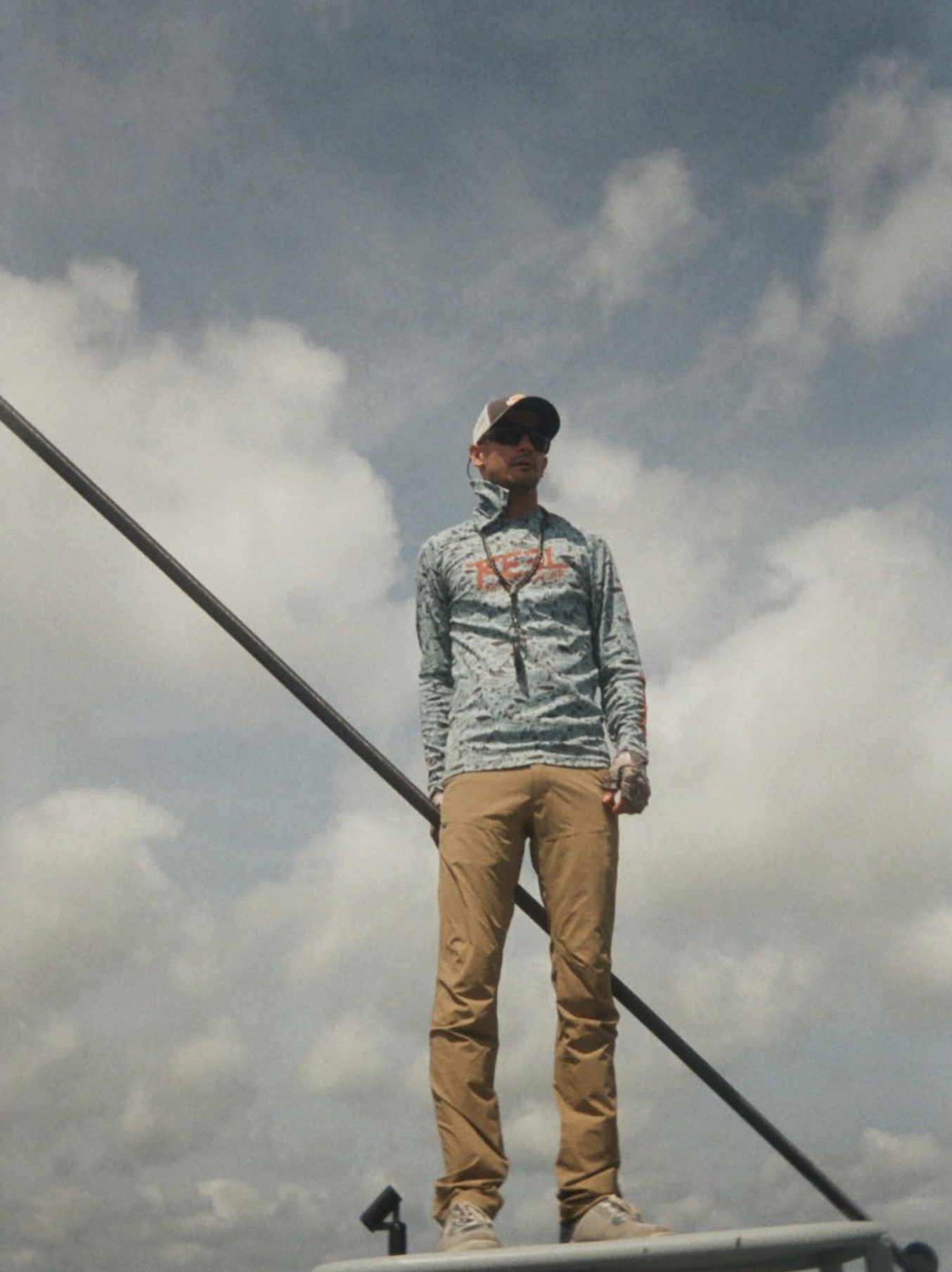
Cody built TideStrike because nothing on the market worked for the water he fishes. He's a local angler who got tired of
assembling a tide picture out of four sources and decided to build the app he wanted. Matt fishes the same water and has spent years talking to the people who fish it.
So if you check the tide before you go, this was built for you.
Kayak, wade, or skiff — the boat doesn't matter. What matters is that a few tenths of a foot changes where you fish. Bays,
marshes, and flats are what TideStrike is for.
No surprises at the paywall.
You'll know exactly what's free and what isn't before you download.
Join the waitlist
Free, always
$0
NOAA tide predictions
Live water level observations
NWS weather
Station search
TideStrike Plus
$5
/month
Everything in Free
CurrentFlow adjusted forecasts
Custom stations
Fishing journal
Cancel anytime. No ads.
Frequently Asked Questions
Is my water covered?
Tide and weather work anywhere NOAA has a station. CurrentFlow is live on the Texas coast through the
Florida Gulf and Atlantic, with Georgia and the Carolinas in training. Every station card in the app tells you
which you're getting.
−
Where does the data come from?
+
How often does the forecast update?
+
What is CurrentFlow, in plain terms?
+
What's free and what costs money?
+
Will other people see my spots?
+
Does it work offshore?
+
Does it work without cell signal?
+
Is there an Android version?
+
When does it launch?
+
Know the water before you go.
TideStrike launches on iOS September 30. Get on the list and you'll hear from us the morning it goes live.
Email address
Join the waitlist
Tide and water intelligence for inshore anglers.
Launching on iOS September 30, 2026.
Product
How it works
Coverage
Pricing
Join the waitlist
Support
Contact support
FAQs
Privacy policy
Follow
The Empty Stringers
Safety notice. TideStrike is not a navigation, emergency, commercial, professional, or regulated marine safety system.
NOAA and NWS attribution. Tide, water level, weather, and forecast data may be provided by public data services from the National Oceanic and Atmospheric Administration (NOAA), NOAA Tides and Currents, and the National Weather Service (NWS). Some TideStrike features may also use TideStrike-generated processing, modeling, caching, or derived display formats based on those public data sources. TideStrike uses NOAA and NWS data but is not affiliated with, endorsed by, sponsored by, certified by, or approved by NOAA, NWS, the Department of Commerce, or any other government agency. NOAA, NWS, and TideStrike data may be delayed, unavailable, incomplete, or inaccurate. Always check official sources, current local conditions, marine forecasts, weather alerts, charts, notices to mariners, and applicable safety guidance before making decisions on the water.
© 2026 TideStrike. All rights reserved.
Privacy Policy · Support